
 Mägipe
Kalana
Metsalaane
Ervu
Saatse
Kihlepa
Pikevere
Võduvere
Lääne-Nigula Parish
Mägipe
Kalana
Metsalaane
Ervu
Saatse
Kihlepa
Pikevere
Võduvere
Lääne-Nigula Parish
Abruka rear lighthouse on the map, Kuressaare, Estonia
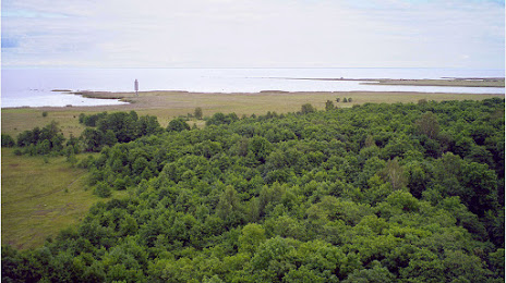
Photo
Where is located Abruka rear lighthouse
Abruka rear lighthouse — local attraction, which is located at Abruka, 93826 Saare County, Estonia and belongs to the category — lighthouse. Average visitor rating for this place — 4.5 (according to 4 ratings, information from open sources and relevant for 2022).
Exact location — Abruka rear lighthouse, marked on the map with a red marker.
You can get directions to Abruka rear lighthouse on the map from your location.
What else is interesting in Kuressaare? You can see all the sights if you go to the city page.
Coordinates
Abruka rear lighthouse, Estonia coordinates in decimal format: latitude — 58.14907167264781, longitude — 22.524299998391456. When converted to degrees, minutes, seconds Abruka rear lighthouse has the following coordinates: 58°8′56.66 north latitude and 22°31′27.48 east longitude.
Nearby cities
The largest cities that are located nearby:
- Rīga
 (Latvia) — 174 km
 - Turku
 (Finland) — 243 km
 - Tartu — 246 km
- Espoo (Finland) — 247 km
- Helsinki (Finland) — 252 km
- Šiauliai
 (Lithuania) — 261 km
 - Vantaa (Finland) — 265 km
- Stockholm
 (Sweden) — 276 km
 - Klaipėda (Lithuania) — 294 km
- Panevėžys (Lithuania) — 302 km
- Uppsala (Sweden) — 322 km
- Pskov
 (Russia) — 348 km
 - Daugavpils (Latvia) — 364 km
- Västerås (Sweden) — 365 km
- Tampere (Finland) — 365 km
- Kaunas (Lithuania) — 382 km
- Kaliningrad (Russia) — 411 km
- Vilnius (Lithuania) — 433 km
- Saint Petersburg (Russia) — 473 km
Distance to the capital
Distance to the capital (Tallinn) is about — 192 km.