
 Ardena
Apiro
Cozzuolo
Amendolea
Grimaldi
Pignano
Case Nuove Russo
Palazzo
Lido di Rivoli
Ardena
Apiro
Cozzuolo
Amendolea
Grimaldi
Pignano
Case Nuove Russo
Palazzo
Lido di Rivoli
Botanical Garden of the University of Ferrara on the map, Ferrara, Italy
Photo
Where is located Botanical Garden of the University of Ferrara
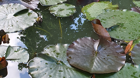
Botanical Garden of the University of Ferrara — local attraction, which is located at Corso Porta Mare, 2B, 44121 Ferrara FE, Italy and belongs to the category — botanical garden. Average visitor rating for this place — 4.1 (according to 196 ratings, information from open sources and relevant for 2022).
Exact location — Botanical Garden of the University of Ferrara, marked on the map with a red marker.
You can get directions to Botanical Garden of the University of Ferrara on the map from your location.
What else is interesting in Ferrara? You can see all the sights if you go to the city page.
Coordinates
Botanical Garden of the University of Ferrara, Italy coordinates in decimal format: latitude — 44.84184634238865, longitude — 11.622386197903262. When converted to degrees, minutes, seconds Botanical Garden of the University of Ferrara has the following coordinates: 44°50′30.65 north latitude and 11°37′20.59 east longitude.
Nearby cities
The largest cities that are located nearby:
- Bologna — 44 km
- Modena — 59 km
- Ravenna — 65 km
- Forli — 76 km
- Vicenza — 78 km
- Verona — 82 km
- Venice — 86 km
- Parma — 101 km
- Rimini — 114 km
- Prato — 114 km
- Florence — 122 km
- Brescia — 134 km
- Trento — 142 km
- Livorno — 177 km
- Bergamo — 178 km
- Trieste — 189 km
- Monza — 199 km
- Perugia — 201 km
- Milan — 201 km
Distance to the capital
Distance to the capital (Rome) is about — 334 km.