
 Staden
Geest-Gerompont-Petit-Rosière
Grote Hut
Sint-Job-in-'t-Goor
Deidenberg
De Pinte
Pussemange
Peruwelz
Barrière de Champlon
Staden
Geest-Gerompont-Petit-Rosière
Grote Hut
Sint-Job-in-'t-Goor
Deidenberg
De Pinte
Pussemange
Peruwelz
Barrière de Champlon
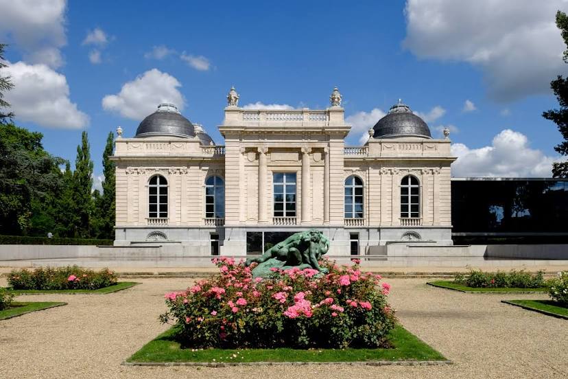
La Boverie (La Boverie - Liege) on the map, Liège, Belgium
Photo
Where is located La Boverie (La Boverie - Liege)
La Boverie (La Boverie - Liege) — local attraction, which is located at Parc de la Boverie, 4020 Liège, Belgium and belongs to the category — museum. Average visitor rating for this place — 4.4 (according to 2163 ratings, information from open sources and relevant for 2022).
Exact location — La Boverie (La Boverie - Liege), marked on the map with a red marker.
You can get directions to La Boverie (La Boverie - Liege) on the map from your location.
What else is interesting in Liège? You can see all the sights if you go to the city page.
Coordinates
La Boverie (La Boverie - Liege), Belgium coordinates in decimal format: latitude — 50.62815575538705, longitude — 5.576945357921707. When converted to degrees, minutes, seconds La Boverie (La Boverie - Liege) has the following coordinates: 50°37′41.36 north latitude and 5°34′37 east longitude.
Nearby cities
The largest cities that are located nearby:
- Maastricht
 (Netherlands) — 25 km
 - Aachen
 (Germany) — 39 km
 - Namur — 53 km
- Charleroi — 84 km
- Mönchengladbach (Germany) — 85 km
- Eindhoven (Netherlands) — 90 km
- Neuss (Germany) — 99 km
- Cologne (Germany) — 102 km
- Antwerp — 104 km
- Krefeld (Germany) — 105 km
- Düsseldorf (Germany) — 106 km
- Bonn (Germany) — 107 km
- Tilburg (Netherlands) — 108 km
- Bergisch Gladbach (Germany) — 115 km
- Moers (Germany) — 116 km
- Breda (Netherlands) — 119 km
- 's-Hertogenbosch (Netherlands) — 119 km
- Solingen (Germany) — 120 km
- Duisburg (Germany) — 120 km
Distance to the capital
Distance to the capital (Brussels) is about — 90 km.