
 Mikhaylovka
Dyrestuy
Mikhaylovka
Mayskiy
Novobessergenevka
Tersky District
Lesnoy
Tertezh
Kuz'minskiye Otverzhki
Mikhaylovka
Dyrestuy
Mikhaylovka
Mayskiy
Novobessergenevka
Tersky District
Lesnoy
Tertezh
Kuz'minskiye Otverzhki
Atkarskiy Krayevedcheskiy Muzey on the map, Atkarsk, Russian Federation
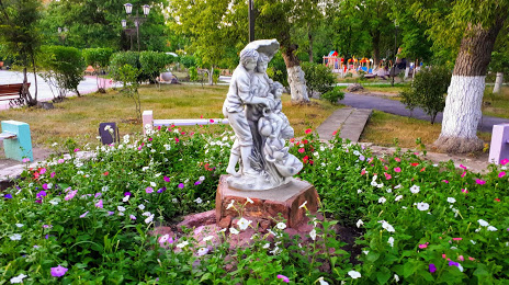
Photo
Where is located Atkarskiy Krayevedcheskiy Muzey
Atkarskiy Krayevedcheskiy Muzey — local attraction, which is located at City Park, Atkarsk, Saratov Oblast, 412420 and belongs to the category — museum. Average visitor rating for this place — 4.7 (according to 31 rating, information from open sources and relevant for 2022).
Exact location — Atkarskiy Krayevedcheskiy Muzey, marked on the map with a red marker.
You can get directions to Atkarskiy Krayevedcheskiy Muzey on the map from your location.
What else is interesting in Atkarsk? You can see all the sights if you go to the city page.
Coordinates
Atkarskiy Krayevedcheskiy Muzey, Russian Federation coordinates in decimal format: latitude — 51.87598013493143, longitude — 45.000519798308545. When converted to degrees, minutes, seconds Atkarskiy Krayevedcheskiy Muzey has the following coordinates: 51°52′33.53 north latitude and 45°0′1.87 east longitude.
Nearby cities
The largest cities that are located nearby:
- Saratov — 79 km
- Engels — 87 km
- Penza — 147 km
- Balakovo — 190 km
- Kamyshin — 199 km
- Saransk — 256 km
- Tambov — 257 km
- Syzran — 271 km
- Volzhskiy — 339 km
- Tolyatti — 343 km
- Ulyanovsk — 347 km
- Volgograd — 352 km
- Novokuybyshevsk — 355 km
- Samara — 371 km
- Lipetsk — 372 km
- Dimitrovgrad — 394 km
- Voronezh — 398 km
- Arzamas — 398 km
- Yelets — 444 km
Distance to the capital
Distance to the capital (Moscow) is about — 648 km.