
 Mikhaylovka
Dyrestuy
Mikhaylovka
Mayskiy
Novobessergenevka
Tersky District
Lesnoy
Tertezh
Kuz'minskiye Otverzhki
Mikhaylovka
Dyrestuy
Mikhaylovka
Mayskiy
Novobessergenevka
Tersky District
Lesnoy
Tertezh
Kuz'minskiye Otverzhki
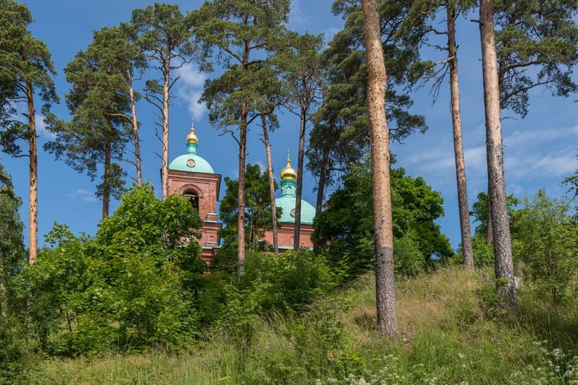
Svyato-Voskresenskiy Muzhskoy Monastyr' on the map, Tolyatti, Russian Federation
Photo
Where is located Svyato-Voskresenskiy Muzhskoy Monastyr'
Svyato-Voskresenskiy Muzhskoy Monastyr' — local attraction, which is located at Nagornaya Ulitsa, 1а, Tolyatti, Samara Oblast, 445003 and belongs to the category — monastery. Average visitor rating for this place — 4.7 (according to 312 ratings, information from open sources and relevant for 2022).
Exact location — Svyato-Voskresenskiy Muzhskoy Monastyr', marked on the map with a red marker.
You can get directions to Svyato-Voskresenskiy Muzhskoy Monastyr' on the map from your location.
What else is interesting in Tolyatti? You can see all the sights if you go to the city page.
Coordinates
Svyato-Voskresenskiy Muzhskoy Monastyr', Russian Federation coordinates in decimal format: latitude — 53.47255414860592, longitude — 49.364737598368144. When converted to degrees, minutes, seconds Svyato-Voskresenskiy Muzhskoy Monastyr' has the following coordinates: 53°28′21.19 north latitude and 49°21′53.06 east longitude.
Nearby cities
The largest cities that are located nearby:
- Novokuybyshevsk — 57 km
- Samara — 59 km
- Syzran — 74 km
- Dimitrovgrad — 80 km
- Ulyanovsk — 112 km
- Balakovo — 197 km
- Almetyevsk — 240 km
- Kazan — 253 km
- Zelenodolsk — 265 km
- Nizhnekamsk — 279 km
- Saransk — 284 km
- Penza — 294 km
- Novocheboksarsk — 310 km
- Engels — 318 km
- Saratov — 320 km
- Cheboksary — 322 km
- Yoshkar-Ola — 358 km
- Arzamas — 409 km
- Neftekamsk — 415 km
Distance to the capital
Distance to the capital (Moscow) is about — 797 km.