
 Mikhaylovka
Dyrestuy
Mikhaylovka
Mayskiy
Novobessergenevka
Tersky District
Lesnoy
Tertezh
Kuz'minskiye Otverzhki
Mikhaylovka
Dyrestuy
Mikhaylovka
Mayskiy
Novobessergenevka
Tersky District
Lesnoy
Tertezh
Kuz'minskiye Otverzhki
Istoriko Krayevedcheskiy Muzey "Samarskaya Luka" on the map, Tolyatti, Russian Federation
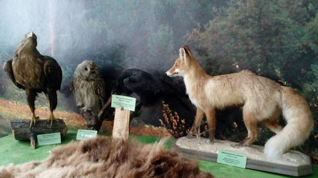
Photo
Where is located Istoriko Krayevedcheskiy Muzey "Samarskaya Luka"
Istoriko Krayevedcheskiy Muzey "Samarskaya Luka" — local attraction, which is located at Komsomol'skaya Ulitsa, 28, Zhigulevsk, Samara Oblast, 445350 and belongs to the category — local history museum. Average visitor rating for this place — 4.5 (according to 59 ratings, information from open sources and relevant for 2022).
Exact location — Istoriko Krayevedcheskiy Muzey "Samarskaya Luka", marked on the map with a red marker.
You can get directions to Istoriko Krayevedcheskiy Muzey "Samarskaya Luka" on the map from your location.
What else is interesting in Tolyatti? You can see all the sights if you go to the city page.
Coordinates
Istoriko Krayevedcheskiy Muzey "Samarskaya Luka", Russian Federation coordinates in decimal format: latitude — 53.40464808860786, longitude — 49.49407469836549. When converted to degrees, minutes, seconds Istoriko Krayevedcheskiy Muzey "Samarskaya Luka" has the following coordinates: 53°24′16.73 north latitude and 49°29′38.67 east longitude.
Nearby cities
The largest cities that are located nearby:
- Novokuybyshevsk — 57 km
- Samara — 59 km
- Syzran — 74 km
- Dimitrovgrad — 80 km
- Ulyanovsk — 112 km
- Balakovo — 197 km
- Almetyevsk — 240 km
- Kazan — 253 km
- Zelenodolsk — 265 km
- Nizhnekamsk — 279 km
- Saransk — 284 km
- Penza — 294 km
- Novocheboksarsk — 310 km
- Engels — 318 km
- Saratov — 320 km
- Cheboksary — 322 km
- Yoshkar-Ola — 358 km
- Arzamas — 409 km
- Neftekamsk — 415 km
Distance to the capital
Distance to the capital (Moscow) is about — 808 km.