
 Dovsk
Smaliavichy District
Гута
Семежава
Zavosse
Karčova
Hatava
Radkovo
Surovni
Dovsk
Smaliavichy District
Гута
Семежава
Zavosse
Karčova
Hatava
Radkovo
Surovni
National Polatsk Historical and Cultural Open-air Museum on the map, Polatsk, Belarus
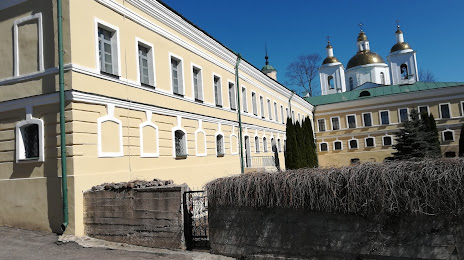
Photo
Where is located National Polatsk Historical and Cultural Open-air Museum
National Polatsk Historical and Cultural Open-air Museum — local attraction, which is located at Nižnie-Pakroŭskaja vulica 22, Polatsk, Belarus and belongs to the category — museum. Average visitor rating for this place — 4.7 (according to 79 ratings, information from open sources and relevant for 2022).
Exact location — National Polatsk Historical and Cultural Open-air Museum, marked on the map with a red marker.
You can get directions to National Polatsk Historical and Cultural Open-air Museum on the map from your location.
What else is interesting in Polatsk? You can see all the sights if you go to the city page.
Coordinates
National Polatsk Historical and Cultural Open-air Museum, Belarus coordinates in decimal format: latitude — 55.483485123066274, longitude — 28.767693625469587. When converted to degrees, minutes, seconds National Polatsk Historical and Cultural Open-air Museum has the following coordinates: 55°29′0.55 north latitude and 28°46′3.7 east longitude.
Nearby cities
The largest cities that are located nearby:
- Navapolatsk — 15 km
- Velikiye Luki
 (Russia) — 142 km
 - Daugavpils
 (Latvia) — 147 km
 - Maladzyechna — 181 km
- Smolensk (Russia) — 221 km
- Vilnius
 (Lithuania) — 242 km
 - Pskov (Russia) — 259 km
- Babruysk — 260 km
- Panevėžys (Lithuania) — 278 km
- Salihorsk — 310 km
- Kaunas (Lithuania) — 318 km
- Baranovichi — 320 km
- Rīga (Latvia) — 326 km
- Tartu
 (Estonia) — 342 km
 - Šiauliai (Lithuania) — 343 km
- Gomel — 367 km
- Mazyr — 383 km
- Pinsk — 415 km
- Bryansk (Russia) — 445 km
Distance to the capital
Distance to the capital (Minsk) is about — 192 km.