
 Itoshima
Saikai
Izumi
Ichikikushikino
Uruma
Kirishima
Kunisaki
Bungotakada
Gotsu
Itoshima
Saikai
Izumi
Ichikikushikino
Uruma
Kirishima
Kunisaki
Bungotakada
Gotsu
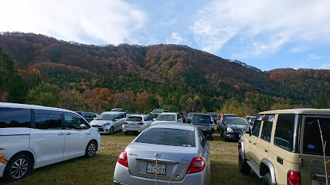
Mt. Ochosan & Mt. Akausagiyama Trailhead on the map, Katsuyama, Japan
Photo
Where is located Mt. Ochosan & Mt. Akausagiyama Trailhead
Mt. Ochosan & Mt. Akausagiyama Trailhead — local attraction, which is located at Japan, 〒911-0001 Fukui, Katsuyama, 北谷町 and belongs to the category — hiking area. Average visitor rating for this place — 4.1 (according to 37 ratings, information from open sources and relevant for 2022).
Exact location — Mt. Ochosan & Mt. Akausagiyama Trailhead, marked on the map with a red marker.
You can get directions to Mt. Ochosan & Mt. Akausagiyama Trailhead on the map from your location.
What else is interesting in Katsuyama? You can see all the sights if you go to the city page.
Coordinates
Mt. Ochosan & Mt. Akausagiyama Trailhead, Japan coordinates in decimal format: latitude — 36.080186838598095, longitude — 136.51948432739633. When converted to degrees, minutes, seconds Mt. Ochosan & Mt. Akausagiyama Trailhead has the following coordinates: 36°4′48.67 north latitude and 136°31′10.14 east longitude.
Nearby cities
The largest cities that are located nearby:
- Fukui — 25 km
- Komatsu — 39 km
- Kanazawa — 57 km
- Gifu — 74 km
- Ogaki — 78 km
- Kakamigahara — 80 km
- Ichinomiya — 88 km
- Takaoka — 90 km
- Hikone — 90 km
- Komaki — 93 km
- Inazawa — 93 km
- Toyama — 94 km
- Tajimi — 99 km
- Kasugai — 99 km
- Nagoya — 104 km
- Seto — 107 km
- Kuwana — 112 km
- Yokkaichi — 122 km
- Konan — 123 km